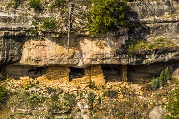
Nestled in the Sonoran Desert near Coolidge, Arizona, Casa Grande Ruins National Monument is a doorway into the ancient past. As a travel writer, I was captivated not only by the iconic “Great House”—a towering four-story adobe marvel—but also by the rich history and enduring spirit of the landscape and its people.
🏜️ A Monument Steeped in Time
The Great House, constructed around 1350 CE, dominates the site with its caliche walls—Adobe crafted from desert subsoil hardened over centuries . The structure is surrounded by a bustling Hohokam agricultural community that flourished from around 1150 to 1450 CE, sustained by an ingenious system of irrigation canals tapping into the Gila River .
Archaeologists believe Casa Grande served multiple roles: a ceremonial observatory aligned with solar and lunar events, a gathering spot, and a central node in a thriving trade network . While the Hohokam mysteriously abandoned the site around 1450 CE, descendants in the O’odham, Hopi, and Zuni tribes maintain enduring cultural connections.
📜 From Protection to Preservation
Remarkably, Casa Grande was the very first archaeological reserve in the United States, set aside in 1892, and later designated a National Monument in 1918 . Over time, efforts to stabilize the Great House culminated in the iconic protective canopy designed by Olmsted Jr. in 1932—a steel ramada that helps preserve the fragile walls from erosion .
What began as early conservation has evolved into a site where interpretive exhibits, guided tours, and ranger programs bring the human story vividly to life.
🎒 A Day in the Desert
Just 20 minutes from Interstate 10, the park is refreshingly accessible—no entrance fee and open daily, though seasonal hours differ slightly . A typical visit spans around two hours, and here’s what makes it special:
- Visitor Center & Museum: Hands-on exhibits, artifacts, traditional baskets and pottery, plus a short film detailing Hohokam life and the site’s significance .
- Guided Tours & Ranger Talks: Discover astronomy, engineering, and cultural insights through engaging park staff-led sessions .
- Trail Around the Ruins: Photo opportunities abound around the Great House. You’ll also find a ballcourt, compound walls, and an interpretive trail through native plant gardens .
- Operate with Care: Mornings or cooler months offer more pleasant conditions. Shade is scarce, so bring water, sunscreen, hats, and maybe even an umbrella .
During my visit, midday desert sun scorched the fields, but refuge under the ramada revealed fine masonry details, horned-owl nests tucked in rafters—a delicate balance of nature and history preserved over centuries .
🌿 Beyond the Ruins
Coolidge makes a charming gateway town—stop at local cafés or drive through cotton fields nourished by the same ancient irrigation methods . Nearby, the Gila River Indian Community and Huhugam Heritage Center showcase tribal crafts, oral histories, and cultural events .
For travelers crafting a Southwestern itinerary, Casa Grande sits perfectly between Phoenix and Tucson—an enriching stop alongside destinations like Saguaro National Park, Tuzigoot, and Montezuma Castle .
✨ Why It Resonates
Casa Grande isn’t just an archaeological marvel—it’s a vibrant intersection of past and present. It invites us to reflect on human ingenuity able to shape community and infrastructure in unforgiving terrain. Today, it connects us to the Sonoran Desert’s original inhabitants and their descendants, who carry forward its story.
📝 Travel Tips
|
Tip |
Details |
|
Best Time to Visit |
Morning or off-season to beat heat |
|
Essentials |
Water, shade, hat, sunscreen, camera—don’t leave the umbrella! |
|
Visitor Center Hours |
9 AM–4 PM (summer) or 9 AM–5 PM (winter) |
|
Admission |
Free |
|
Suggested Duration |
1–2 hours; longer with tours |
|
Nearby Stops |
Huhugam Heritage Center, Coolidge, cotton fields, Sunrise/Sunset views |
Final Thoughts
Walking amid the echos of this thousand-year-old community, I found Casa Grande sudden yet calm, both historian and poet. Here’s a place that challenges us to think across time: about the desert’s thirst, communal vision, and the people who live on. It’s a moment of both awe and connection—a must‑experience when journeying through Arizona’s cultural and natural heart.